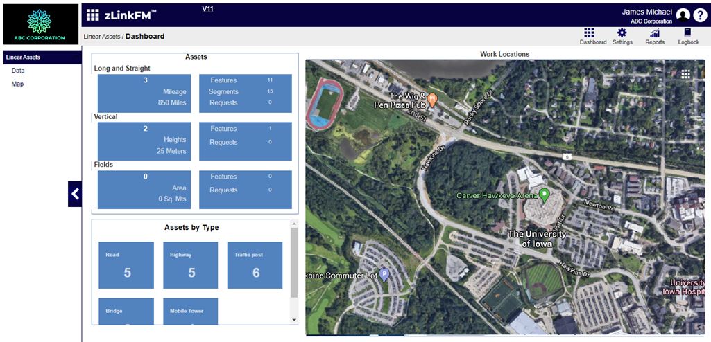
Visualize Linear Asset locations- highways, roads, railways tracks, utilities, pipelines, and powerlines accurately depicted and integrated with mapping systems to visualize physical location.Correlate a map location (GIS) with data for real estate management.The system tightly couples drawings, documents, data, and GIS related information to facilitate the management and maintenance of all asset types:
Facilities
Roads
Bridges
Fleets
Use spatial GIS context for locating the infrastructure assets such as roads and drainage systems. Integrate assets, inventory, work orders, GIS mapping, and capital planning – tracking information across multiple sites and campuses.
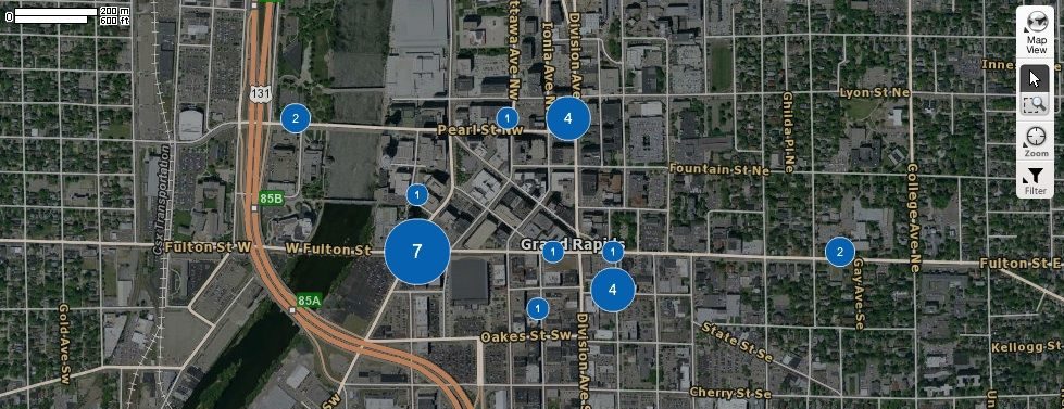
Assets and related data displayed in GIS Maps
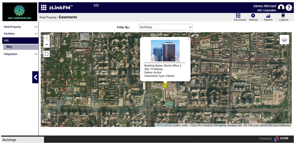
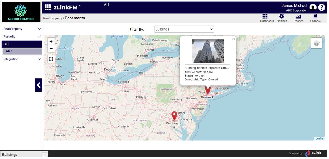
Buildings and Linear Assets linked to GIS Maps
Map based location of Linear Asset related Work Orders
Mark areason a map; attach photographs and other attributes
Easy pavement and roadway management
Manage Right of Way related information
Integrate engineering drawings, models, infrastructure, GIS, and corporate databases
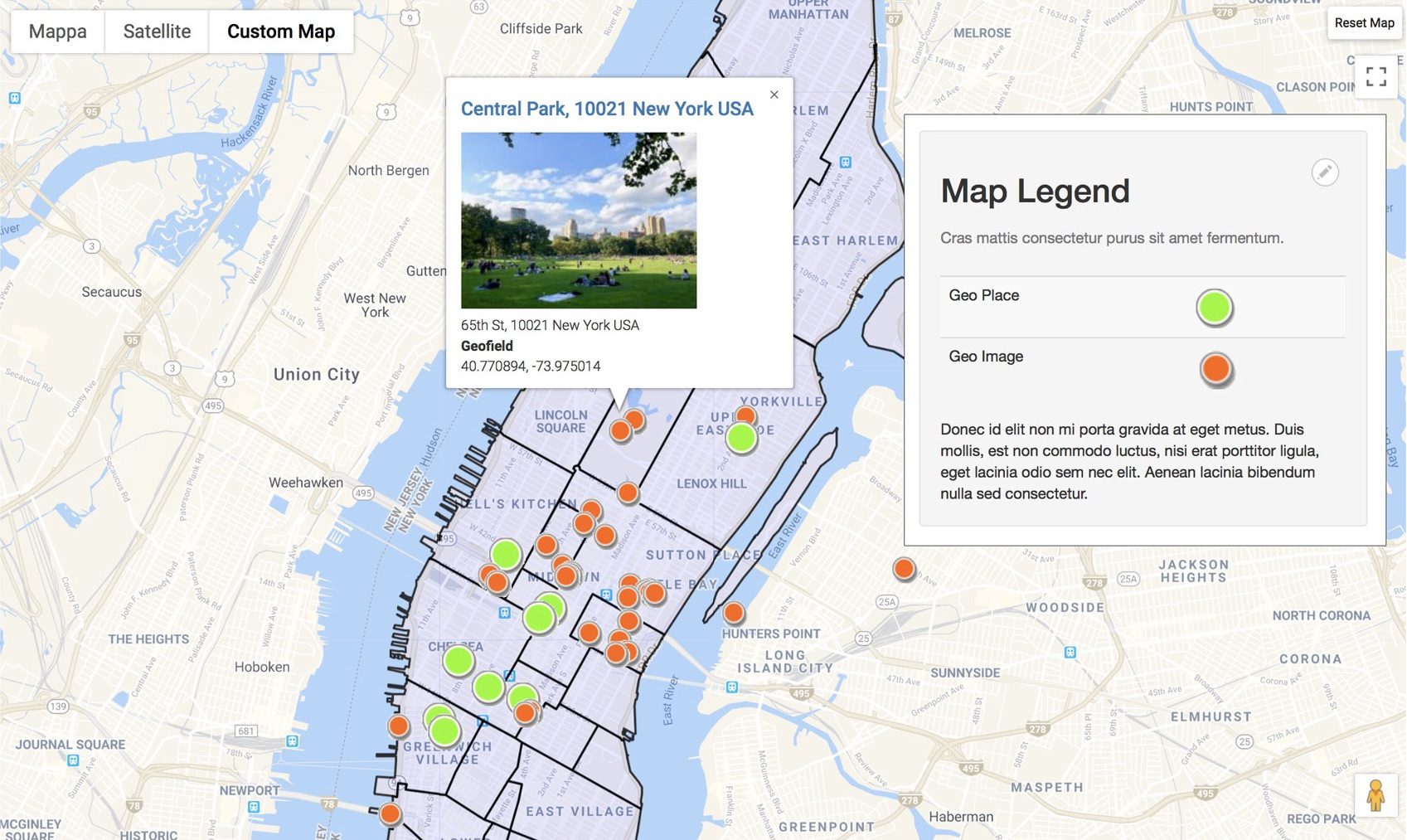
zLink’s GIS integration enables location-specific asset data. Linear assets linked to physical location provides a wide variety of more meaningful reports. GIS Mapping allows for easy, frequent updating, resulting in more accurate asset documentation and reporting.
Technology
zLinkFM provides a broad set of technology functions based on integration with industry standard mapping applications such ESRI ArcGIS, Open System Maps, and GPS Insight for fleet location.
Linear referencing system using map layers
Satellite and street views of assets
Definition of Linear Assets on GIS maps – such as road and utility segments
Tightly coupled maps and assets for GIS based Work Orders and Service Requests
Flexible GIS object searches
zLinkFM GIS Interface